Try Super Resolution (SR) for free!
Discover how low-res satellite images become sharper and more detailed. Limited-time offer. Don’t miss out!
※ For more details, see the description below.

Super Resolution
You can currently try our Super Resolution (SR) service for free on EP Map, using Sentinel-2 satellite imagery.
If you’d like to enhance satellite images you already own, we also offer Super Resolution processing as a paid service.
Low Resolution
> 8 m
Medium Resolution
1 m ~ 7.99 m
High Resolution
0.5 m ~ 0.99 m
Very High Resolution
≤ 0.49 m
List of Satellite Imagery Eligible for Super Resolution
- Low resolution (> 8 m): Sentinel-2
- Medium resolution (1 m – 7.99 m): Planetscope, BlackSky
- High resolution (0.5 m – 0.99 m): Pleiades
- Very high resolution (< 0.49 m): Pleiades Neo, WorldView-2/3
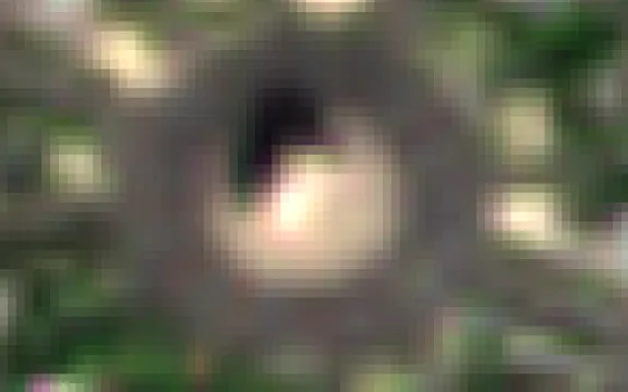
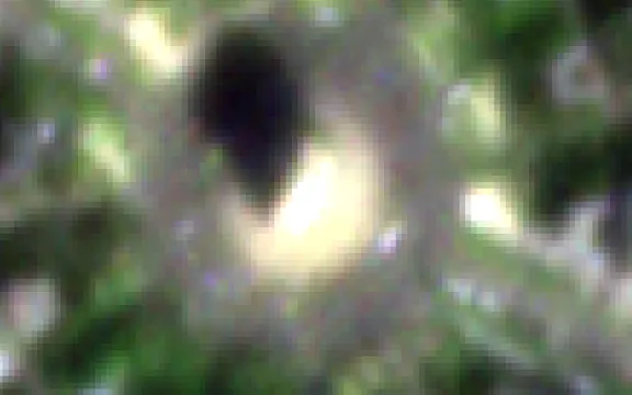
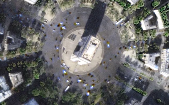
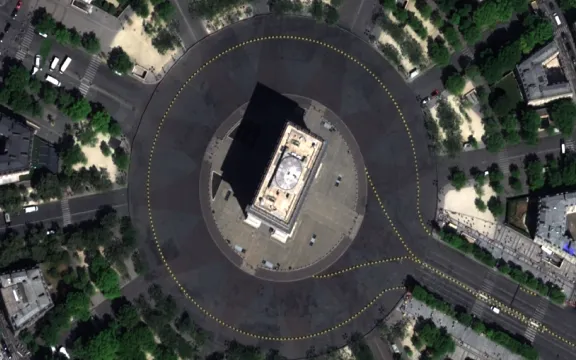
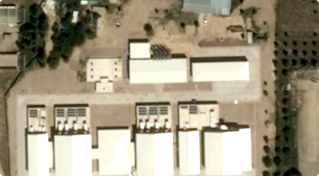
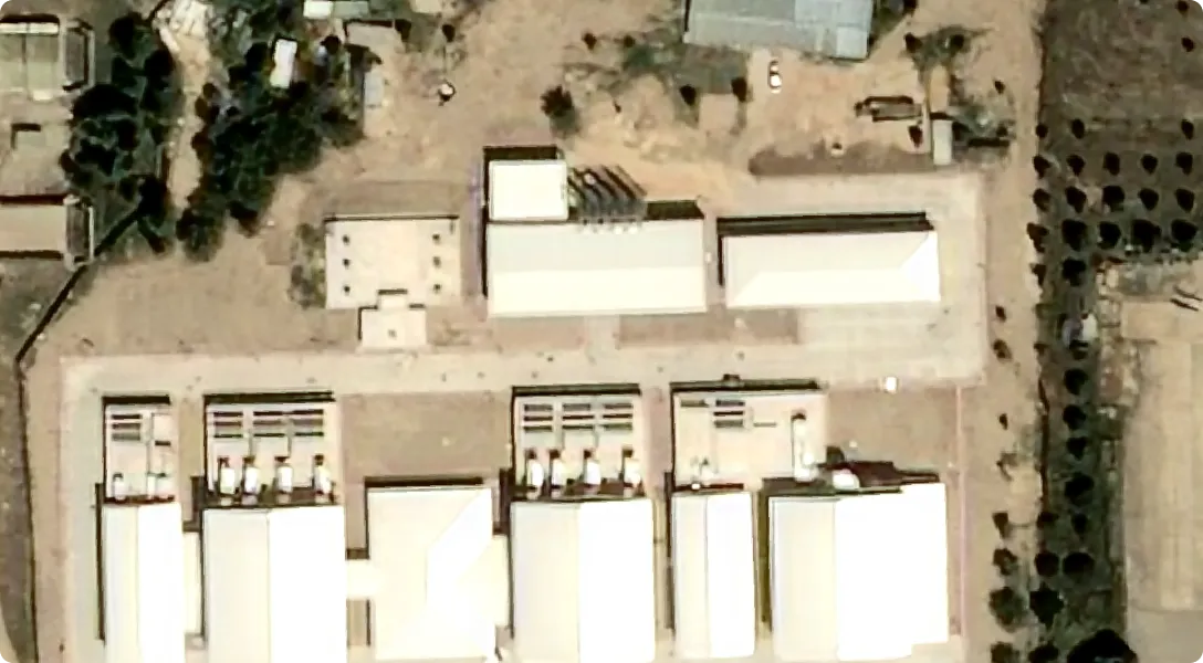
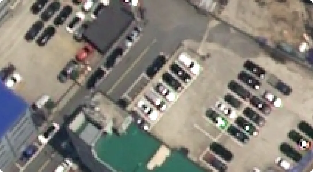
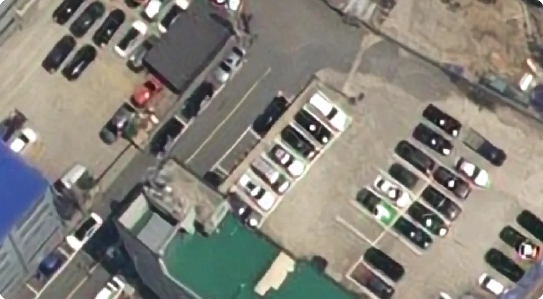
Super Resolution Example
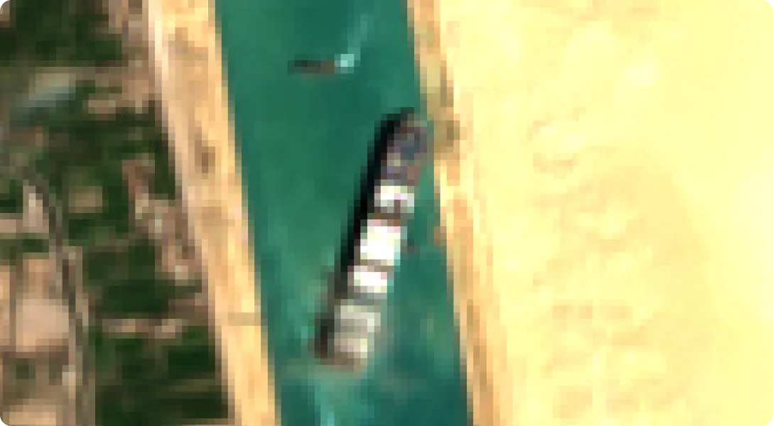
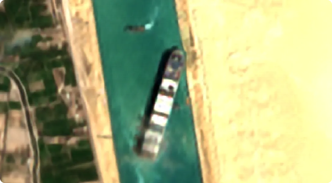
Copernicus Sentinel data [2022] for Sentinel data
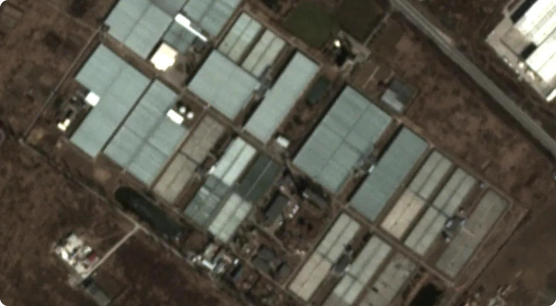
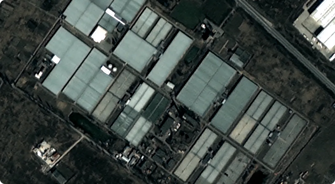
Planet Labs PBC
©CNES (2022), Distribution AIRBUSDS
©Airbus DS (2022)
If you'd like to request Super Resolution for your own satellite imagery, please contact us.